Sensory Overload on the Laugavegur Trek

Words and digital photos by Nate Dodge, with film photos from Alex Eaton.

Two full years without international travel due to Covid-19 shutdowns had me itching for adventure. I had still been getting after it stateside with trips to Idaho, California, and Utah, but I wanted something big. I wanted to revisit a place I had seen in the winter 3 years earlier when I only got a glimpse of what it had to offer.
Enter Iceland.
After a long day of travel with little to no sleep, we arrived in Reykjavik at 6:00am and spent the day running errands for last minute supplies and double checking our route for the next 4 days. Early the next morning, we lugged our heavy packs a few miles across town to catch the bus from Reykjavik to Landmannalaugar where the famous Laugavegur Trek officially begins. The Laugavegur which translates to ‘the hot spring route’ is one of the most impressive long-distance trails in the world. Beginning in Landmannalaugar surrounded by geothermal springs, the trail leads you about 35 miles south to Thorsmork (Þórsmörk - The Valley of Thor) through striking landscapes including glaciers, gorges, and colorful rhyolite mountains. A backcountry hut system spans the route which you can book in advance or pay upon arrival, pending availability, and next to each hut is a tent camping area which we opted for.

Day 1 | Landmannalaugar —> Hrafntinnusker | 6.26 miles | 2,372’ elevation gain
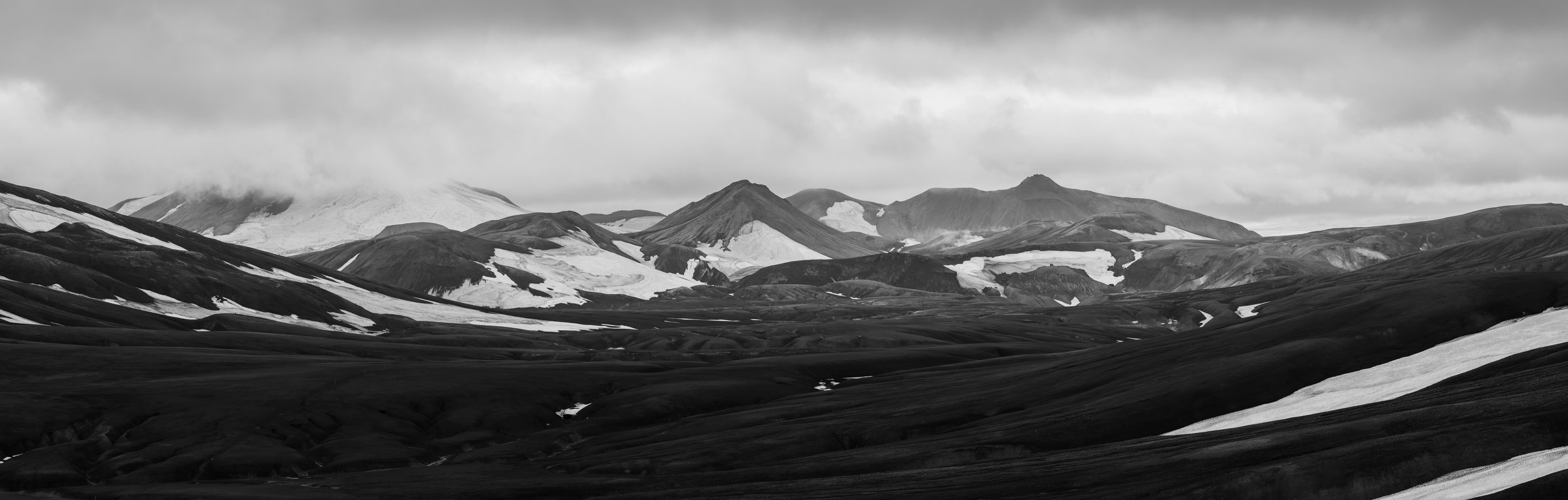
The scenic 4 hour drive from Reykjavik carried us deep into the highlands and we arrived to the start of the trail alongside hundreds of other hikers. We were visiting in shoulder season so I was surprised and somewhat concerned with the number of people here.
Fortunately, most appeared to be setting up camp right there or just day hiking, so as we made our way out onto the first leg of the trail, we were soon alone. The route rises quickly, past hot springs and steaming earth with spectacularly colored mountains in just about every direction. This made for pretty slow progress as we stopped to take photos at every new overlook.

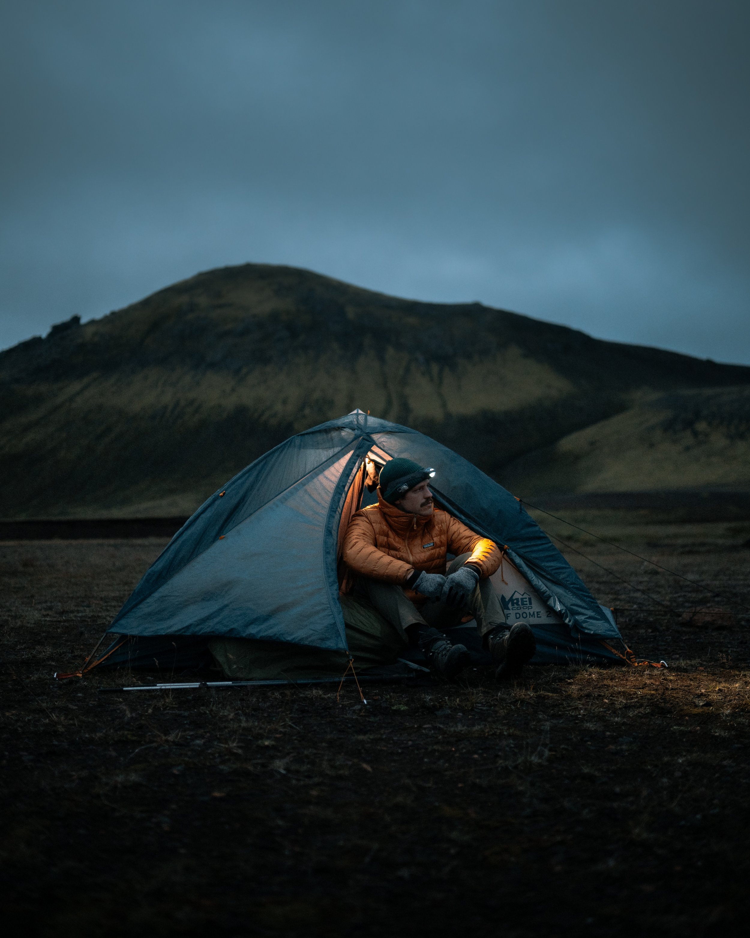
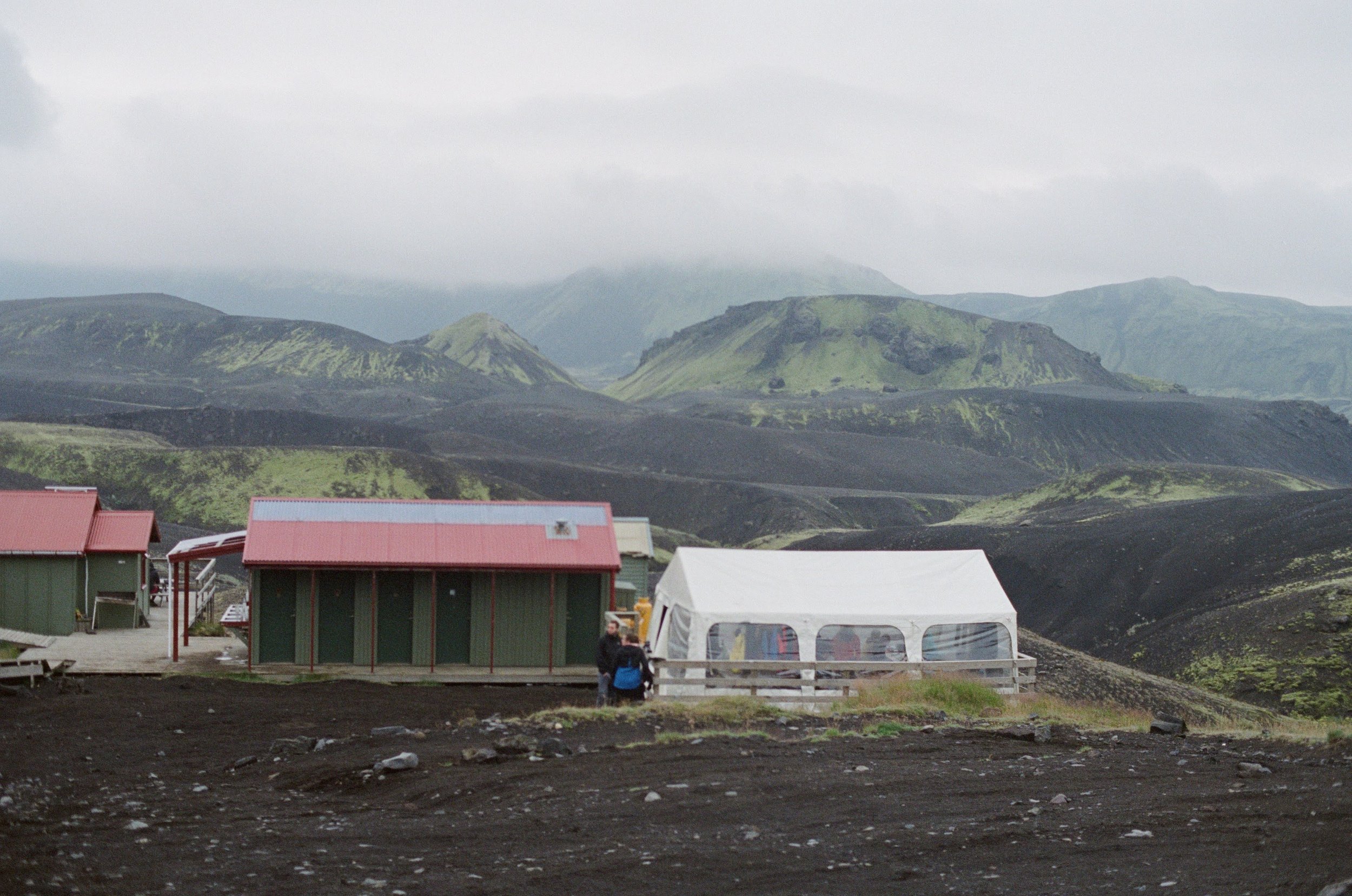
The climb finished at Hrafntinnusker Hut which would be our high point on the trail and camp for the first night. It’s also completely exposed so the wind wreaked havoc on everyone’s tents. Luckily people have built up lava rock walls big enough to surround a tent which did provide some shelter from the wind. We both donned our warmest jackets to set up camp and tossed a couple rocks into the corners of our tent to keep it from blowing away. Then later when we blew up our air mattresses and got ready for bed, we both found ourselves flat against the cold, hard ground. A couple of geniuses had brought lava rocks into the tent which scraped holes in both of our pads. Twenty minutes of searching every square inch and we finally found and patched the holes and went to sleep. This is why you always backpack with a repair kit!


Alex hunkering down behind our shelter. Expression says it all.


Day 2 | Hrafntinnusker —> Álftavatn | 6.76 miles | 1,114’ elevation gain
We rose in the morning to a harsh 5:30am alarm to peak outside and check for a sunrise. Totally socked in so we went back to sleep until after 10:00am. Apparently jet lag was very much still with us. As we packed the tent, the last hikers hit the trail for the day leaving us in the dust. I like a slow morning in the mountains though. We made coffee and hot oatmeal and leisurely organized our backpacks to be ready to walk by noon for the short 6.5 mile day that lay ahead.
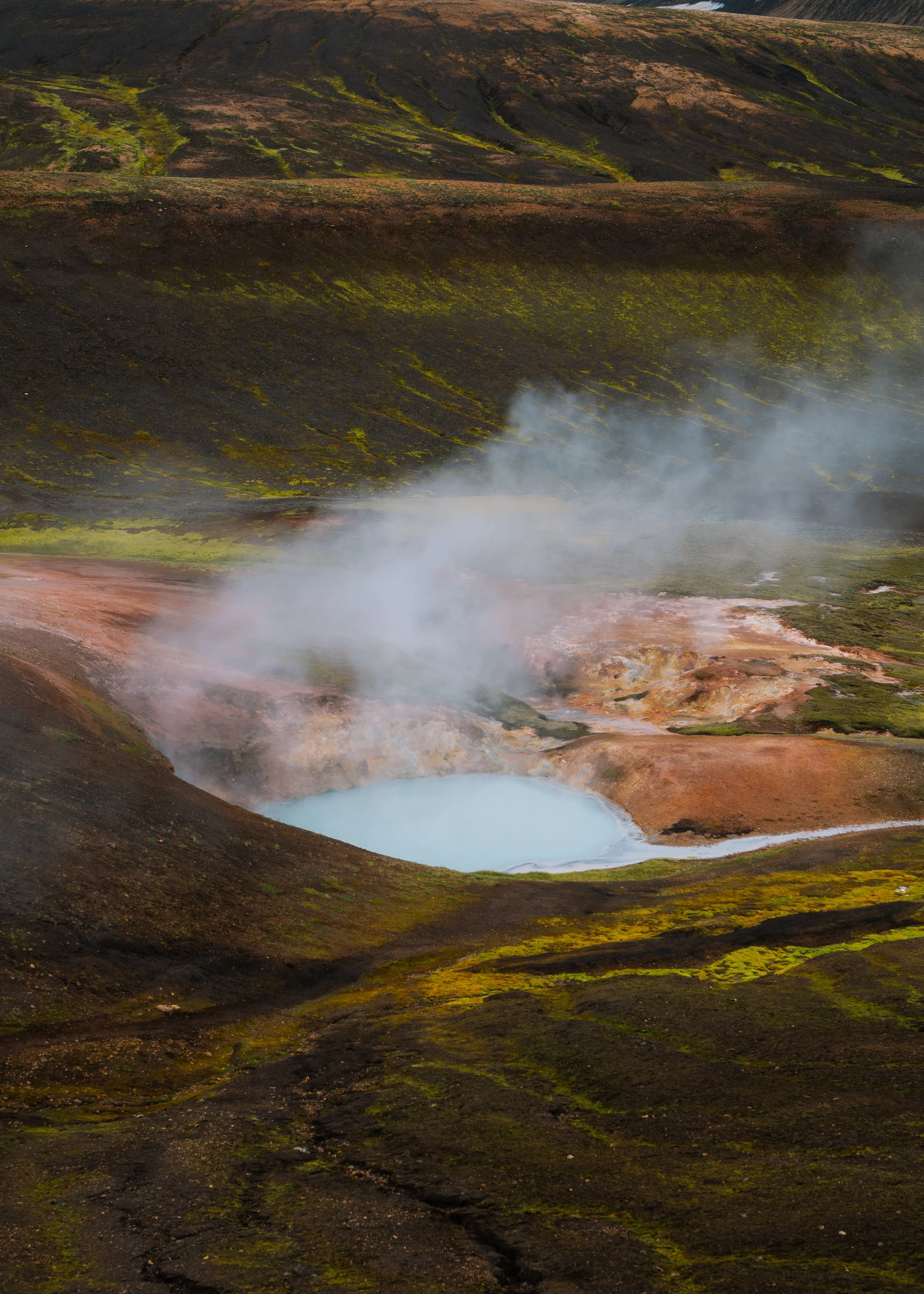
A final map check to get familiar with the day’s route was when we noticed an icon for some ice caves right around the corner. We popped inside the hut to ask the warden if he knew anything about them and he said that if we could spare the time, the ice caves are a must see!
Shit. We were kind of hoping for the opposite response since we were already so late and eager to get moving for the day. But if you know Alex and I, you know that we simply cannot pass up an opportunity to explore the unknown. So with that, we stashed our packs in the hut and made our way around the mountain following a faint footpath littered with glassy obsidian. The trail spit us out onto a massive snowfield which gave way to our first views of the caves. It was really a glacier that was calving where it merged with a geothermal spring steaming with boiling water and colorful minerals. Literally two worlds colliding. We climbed down to the base and found an explosion of colors moving underneath the massive ice wall. Neon red sediment and fluorescent green moss blossomed from every bubbling pit, while above us hung blue walls of ice that would occasionally collapse in a jarring thunder. A call to ward off entry into the caves. We spent the better part of two hours here obsessing over every little detail and taking far too many photos. I basically had to drag Alex away.


Three o’clock rolled around and we finally made our first forward progress of the day across a long volcanic valley. After a short distance, the classic Icelandic weather that we were told to expect finally emerged as the skies opened up. Over the course of these four days, we’d make our fastest time in the worst weather for one simple reason: the cameras were safely stashed in our packs. As we trudged on, the landscape transitioned from brown and white to lush green as every mountainside was wrapped in a dense moss. A river crossing and a final flat stretch brought us into Álftavatn where we’d find the only restaurant along the trail. It was pretty funny seeing a restaurant out there in the middle of the highlands, and even funnier that there were people inside eating $50 bowls of chili. We skipped the pricey food but did however partake in a few Víking beers.


Day 3 | Álftavatn —> Emstrur | 9.82 miles | 1,664’ elevation gain
Day three began as day two ended; wind and rain. But as our coffee steamed in our cold hands, the sun poked through and lit up the surrounding mountains in a crazy golden beam of light. We packed up our wet gear to hit the trail and not even 30 steps from the hut, the skies opened up again and we had to stop and put the rain gear back on. We had made it a comically short distance and should have just started with it on. Sorry for being optimistic.


The first bend in the trail gave way to the towering Stórasúla, a huge moss-covered volcano rising 3,000 vertical feet from the valley. The trail rounds the volcano for miles and features several deep river crossings which were quite refreshing on the feet. We crushed out the next 5 or so miles of perfectly flat volcanic valley and passed almost everybody who started before us. Then right on schedule, the rains returned and fell consistently for the rest of the hike leaving us completely soaked through and chilled. The whole trek so far we chatted about how the tent campers get the short end of the stick. If you don’t book the huts, there are no shelters, roof overhands, or anything to get you out of the elements until you’re inside your tent. Your wet gear never has the chance to dry out. But, cresting the final hill of day three with Emstrur Hut coming into view, we spotted a small, white, banquet-style tent. Miraculously, the tent campers were indeed allowed inside and it was quickly packed with wet, stinky backpackers firing stoves and hanging up soggy gear. It was quite the community in there and we especially enjoyed when the hut goers would wander out in their pajamas and complain about how noisy it was inside in the warmth. Perspective.

We overheard talks about a big canyon only a twenty minute walk from the hut and even though we were tired, wet, and ready to call it a day, we once again couldn’t miss out on the opportunity and set out with some new friends from Germany and Canada. “Big” was quite the understatement. The gorge is monumental! A glacial river is hard at work a thousand feet below, dozens of waterfalls drop down off the adjacent cliffs, and your legs are left unsteady with vertigo as you stand on the cliffside and stare out into the void. Another absolutely epic scene that most hikers walk straight past.
Tonight’s campsite sits right on the bank of a small creek which lulled me to sleep in probably seconds.

Day 4 | Emstrur —> Thorsmork | 10.8 miles | 1,873’ elevation gain
This morning’s daily sunrise check revealed broken clouds so we figured if there was ever a chance for a sunrise, this was certainly it. We got dressed and scrambled up a mountain in the dark for a view of another behemoth volcano called Hattafell. Sunrise never came but it’s always nice to be out before anyone else.
Over 10 miles to the finish line today with a bus to catch at the end so we made quick work packing up camp and hit the trail early. On our first stop of the day, I discovered a wild blueberry bush that was bursting with ripe berries. I pulled out my collapsible camping mug and filled it to the top so we could snack on them over the next few miles. By now, we were pretty over the dehydrated backpacker meals and most of the day’s conversations consisted of food fantasies. I think we started with breakfast and over the course of an hour or two, made our way into a deep discussion about desert.
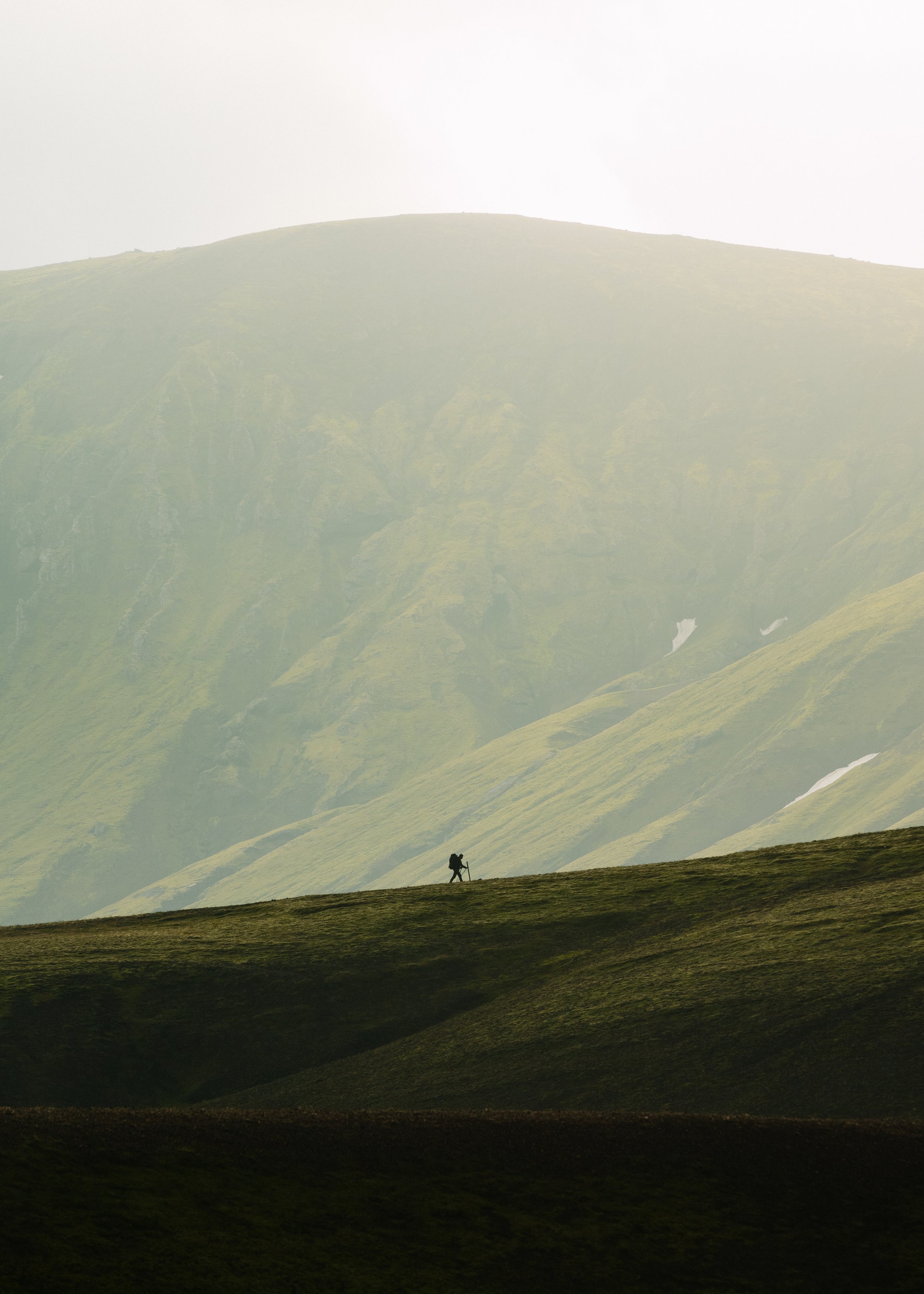
Pretty easy day as we crushed out the miles and made fewer photography stops on our way into Thorsmork. The trail ends in a valley that you could spend weeks exploring, and someday I probably will, but for now we have coffee to make, cheese to finish, and a bus to catch.


The Laugavegur certainly lived up to the hype. Sensory overload around every corner with scenes that I thought only existed in video games and medieval cinema. In the end, we covered about 60 miles with 7,000 feet of elevation gain with all of the side trails and wanderings around camp. Now it’s back to town for a pizza and a beer before the next leg of the trip begins.
Thanks for reading and stay adventurous!